Category Archives: Travel

Hawaiian Sea Turtles Up Close and Personal

On our last day in Hawaii we negotiated a late checkout (noon) but still had many hours to kill until our red-eye left just before midnight.  One of the things that we had not yet done was see some Sea Turtles so, after a little research, we visited the Kaloko-Honokōhau National Historical Park which is about 2 miles (3 kilometres) south of the Kona International Airport.  We went into the main area just off of the Queen Kaahumanu Highway but when we said that we were looking for turtles they sent us out to the main highway to enter at the South edge of the park along a road called the Kealakehe Parkway.  Eventually you turn right off of this road in the direction of the Honokohau Beach.

When we got there it only took a few seconds to find some Green Sea Turtles as they were within feet of the shoreline foraging.  It didn’t hurt that there was another person wading only inches from one of the turtles taking pictures.  The turtles did not seem to mind our presence which made taking their picture quite easy.  The hardest part was being ready when they raised their head out of the water for a few seconds every few minutes.

The following three pictures show some different views of the turtles.  The first shows an entire turtle (they are about 3 feet long) at the water’s surface looking for food on the bottom.  The second shows a turtle with head up.  The camera was zoomed in so that only the front half is visible.  Finally, the third turtle was photographed with its head up as well but this time the camera was zoomed in such that the head almost fills the image.

P1130236 - Green Sea Turtle Foraging

P1130259 - Green Sea Turtle Taking a Breath

P1130279 - Green Sea Turtle Up Close

Note that the bottom 2 images were cropped to have an aspect ratio of 1.6 which is common to many computer displays. As a result, both of them make for a pretty cool desktop background or wallpaper!

Enjoy!

Watching a Family of Palila on the Big Island

[Updated December 10 2014 based on feedback.  Additional links on the Palila have been added.]

A recent week-long vacation took us to the Hawaiian Islands (October 26 to November 1). Having previously been to the island of Kauai at the old end of the island chain, we decided to try the island of Hawaii at the other, newer end.  To prevent confusion with the state of Hawaii this is frequently referred to simply as the Big Island.  I had my Panasonic FZ-200 camera along to document the trip.

On the last full day, I signed up for a Rainforest and Dryforest Birding Adventure tour — a day-long outing put on by a tour group called Hawaii Forest and Trail.  They do many other tours too that are not just for birding.  The rest of our group, for instance, went on the Mauna Kea Summit and Stars Adventure trip which takes you up to the volcano’s summit to watch a sunset.

Our trip set out in search of 2 specific target birds.  In the dry forests on the side of Mauna Kea we would be looking for the Palila, a critically endangered species which lives in a single forested area on the volcano’s slopes.  This forested area is the source of the māmane plant which the Palila has adapted to be able to eat and which is toxic to other birds.

In the second part of our excursion, we would travel to some wetter forests where we hoped to find different endemic, the ʻAkiapōlāʻau.

While we were, unfortunately, unable to track down the ʻAkiapōlāʻau, we were extremely successful with the Palila and the rest of this article describes that encounter.

Mauna Kea and the Palila

First, a quick note and the Palila habitat on the slopes of Mauna Kea.

Mauna Kea is still considered to be an active, though dormant, volcano and even though it has not erupted in 4600 years there is still the slim possibility that a lava flow from a future eruption could wipe out this habitat leading to their extinction.  While this might make for a good story in Hollywood, the reality is that there are much more dangerous risks that could well see the Palila gone from these slopes long before they are touched by lava.  Forest fires, for instance could, in the right conditions, very quickly destroy the Palila habitat.  Other threats include introduced species of plants, animals, insects and disease.  The Hawaiian government’s Mauna Kea Forest Restoration Project has lots of good information here.  Finally, according to BirdLife International, the endangered status of the Palila in recent years is also related to rapid population declines as a result of drought that has affected its primary source of food, the māmane plant.

The Palila Plan

The plan was simple.  We parked in an area accessed by a hunter access road on the lower slopes of Mauna Kea.  The trip organizers allowed for up to 4 hours climbing the slopes to find and view the Palila after which time, win or lose, we would head for the second location.

Here is a picture taken near our parking spot and at the lower edge of the area expected to contain the Palila.  Note the sparse trees on fairly open grassland.Mauna Kea slope forest home of the Palila

Here is a second shot taken as we climbed a little further up the Mauna Kea slope.Mauna Kea slope Forest Home to the Palila

Found:  A Family of Palila

According to the guide, on one recent trip they spent most of the allocated time hunting for the Palila and only found them as they were about to quit and move on.  We got lucky and found one after about 15 minutes with another pair showing up shortly thereafter.  In fact it appears that we had found a family unit with male, female and juvenile foraging together.  The juvenile showed typical begging behaviour with fluttering wings and an adult was doing the foraging and feeding of the juvenile though regurgitation as described, for instance, in a Palila wikipedia article.  This article says that both adults will regurgitate to feed the young in our case the male was feeding while the female stood guard, presumably looking for predators.  If the wikipedia article is correct then perhaps they take turns feeding and guarding or perhaps the guarding behaviour only happens occasionally, for instance when a large number of two-legged, orange-vested homo sapiens are also foraging in the area.

If we only consider predators seen historically before the arrival of man on the islands the most likely candidates would probably have been the Hawaiian Short-eared Owl (Pueo) and the Hawaiian Hawk (ʻIo).  It is not clear what threat we birders posed to the Palila though it was clearly not enough to drive them away.  Whether or not the female would have stood guard where and when she did if we had not be there is unclear.

As mentioned earlier, introduced predators are currently one of the Palila’s biggest threats.  These include feral cats and black rats (see for instance this article on the Palila from BirdLife International (birdlife.org).  Mosquitos transmitting avian malaria have also proved very dangerous to the endemic populations of birds.  They are also threatened by habitat degradation especially if it affects the growth and spreading of their primary food sources, the peas from the seed pods of the māmane plant and certain types of caterpillar.  Introduced mammals such as sheep and pigs are particularly bad for disturbing the forest plants.  Through hunting and fencing the threat of these has been reduced.

First Sighting: An adult male processing a māmane pod.

Our first sighting of a Palila was that of an adult male who was processing a māmane pod in the middle of a bush that provided the bird with some protection.  The following 7 pictures, shown in the order that they were taken, cover a period of about 9 seconds.  All of these pictures were cropped from the original size of 4000 x 3000 down to about 1200 x 800.  The displayed images below are shown at a resolution of 640 x 400 though the full-sized cropped images can be viewed clicking on the image and following the link back to Flickr.

P1130094 - cropped

P1130095 - cropped

P1130096 - cropped

P1130097 - cropped

P1130098 - cropped

P1130099 - cropped

P1130100 - cropped

Video of the Male Foraging

The following is a short video that was taken starting 10 seconds after the last picture (above) was taken.  You can hear the group leader describing the bird to some of the birders that were just then discovering it for the first time.  Initially you can see the Palila alternating between working on the māmane pod and raising it’s head up to check its surroundings.

You can also hear the Palila in between the periods where it is working on the māmane pod and also after it appears to be done having released the māmane pod.  Perhaps these calls were communications to the other family members that would be showing up in the seconds that followed the video.  There may even have been a specific message to the juvenile that he (the adult male) was full and that it was time to eat.  This might also explain why he dropped the pod.  It’s not clear why they moved to a different location for the feeding.  Perhaps it was because of our presence or perhaps because it is generally safer to keep moving.

Unfortunately there is a half minute gap between this series of pictures and the next series with adult feeding juvenile.  The only thing that I recall from this period is that the juvenile and adult female arrived to join the adult male and then the female left again.

Second Sighting:  A juvenile begging and being fed by the adult male.

The second set of 7 images were taken over a period of 13 seconds starting 63 seconds after the last picture in the first set or about 38 seconds after the end of the short video.  As mentioned, in these 38 missing seconds the male moved to a different perch and a juvenile and an adult female flew in to join the adult male.  Only the juvenile stayed to be fed by the adult male while the female flew off to, it appears, stand guard (see the third sighting section below).

The sequence between the adult male and the juvenile clearly shows the begging behaviour as well as the regurgitation and transfer of food from adult to juvenile.

P1130102 - cropped

P1130103 - cropped

P1130104 - cropped

P1130105 - cropped

P1130106 - cropped

P1130107 - cropped

P1130108 - cropped
The final image was taken 5 seconds after the previous one and shows the juvenile left alone and somewhat hidden in the foliage while the adult male had moved on, perhaps to start a new cycle of processing māmane pods prior to the next feeding cycle at which point he would call the juvenile to join him there.

Third Sighting: An adult female on guard duty.

The third set of 5 pictures were taken over a period of 24 seconds starting 18 seconds after the last image in the second set.

The adult female Palila, which made a brief appearance off camera took up a position 100 feet or so from where the other two birds were positioned.  Her perch at the top of a bare branch gave her good visibility. She chose a bush that kept all of the birders, which had broken into several groups by this time, on one side of her, perhaps in order to be able to see all of them at once without continually having to look in opposite directions.  As the photos show, she still does look away from time to time, perhaps scanning for other possible threats.  As mentioned previously, the two historic threats where probably the Hawaiian Short-eared Owl (Pueo) and the Hawaiian Hawk (‘Io).  At this point in our trip we had already seen 5 of these owls hunting (one near where we found the Palila) and we had one unconfirmed hawk sighting.

P1130112 - cropped

P1130113 - cropped

P1130114 - cropped

P1130115 - cropped

P1130116 - cropped


I was impressed by the fact that both adult Palilas were caring for what was clearly a juvenile bird.  The splitting of the task of feeing the young was split into roles of foraging and standing guard.  It would have been nice to know if they switched roles from time to time.  Many species, particularly migratory ones, leave their young to fend for themselves at a much younger age or only one of the adults take responsibility for the young.

 Final Thoughts

I acquired my Panasonic FZ-200 camera to help with bird identification but on several occasions it has proven useful in seeing behaviours that I would never have noticed using just binoculars.  The ability to capture large numbers of pictures and even videos with sound provides the opportunity to analyze different aspects of bird sightings that happen too quickly in the field.

It would seem that my camera is rapidly replacing my binoculars as my primary birding equipment.  Here are some things that I might change in the future that might lead to better results:

  • Take more pictures and make more use of burst mode.  You can always delete them later.
  • Take more video clips.  Images can be extracted from these videos though not with the same resolution.  Video also records sound which can be useful in understanding bird behaviour.
  • Bring a tripod.  A remote control cable might be useful as well for the still shots.
  • Make sure that the memory card is fast and has lots of space.  Bringing extra fast cards will encourage taking lots of pictures and videos.
  • Add a directional microphone that plugs into the audio in jack on the camera.
  • Get more people involved.  It would be interesting to see if better behaviour could be captured with a coordinated group of birders taking pictures and videos together.  The camera clocks would obviously need to be either calibrated or synchronized to help determine the order of various events.

It was a fun way to get introduced to a new bird and, while it took a lot of time post-processing, it was definitely more satisfying than a brief sighting and a simple pencil mark on a checklist.

For More on the Palila Check Out the Following Links

The Palila article on Wikipedia.

The Palila Status at BirdLife International (birdlife.org).

The Mauna Kea Forest Restoration Project website from the Hawaiian state government has much more detailed and accurate information on current status and threats to the Palila.

The Facebook page for “A Paradise Lost”, an animated movie about the Palila directed by Laurie Sumiye.

A Visit to Central Zürich

A business trip to Zürich in early June was extended by a few days before and after to accommodate a little sight-seeing. The before-business visit consisted of 2 days in Zürich. During the first of these we walked from our hotel (Hotel Krone) downtown wandering around looking at both architecture and birds.

Here is a visual summary of some of the more interesting things that we saw:

Near the Hotel Krone in Zürich
Tramway in the middle, cars and bicycles on the outside and no place for automobiles to park on the road.

Near the Hotel Krone in Zürich

Old Building near Zürich Hauptbahnhof
Interesting old building with a tower near the train station.

Alpine Swifts over Zürich
The Alpine Swifts were quite active at this building while we were there.

Rock Pigeon

Mandarin Duck
We saw and photographed this Mandarin Duck at a distance.

Common Blackbird
The common blackbird was snacking here. Just three-and-twenty more and we could make a pie.

Chaffinch
Pretty bird with quite a strong song.

Zürich Downtown Street
The narrow streets were interesting and each seemed a little different.

Red-crested Pochard
Male Red-creasted Pochard.

Red-crested Pochard
Female Red-creasted Pochard.

Red-crested Pochard
Returning from a dip this one’s back still had a sheet of water on it.

Red-crested Pochard
A fraction of a second later and the sheet of water had broken up.

Red-crested Pochard
Another instant and the duck’s back appeared dry again.

Narrow stair-walkway between buildings
One of my favourite stair pictures for the day.

Cobblestones, Stairway and Wooden Home
Yet another ramp/stairway climbing a hill.

Cobblestone Path Between Buildings

Singing Chaffinch
This bird was singing merrily away when…

Singing Chaffinch Noticing the Audience
it spotted a small audience forming behind its back.

Common Blackbird Singing

Hiking in the Anza Borrego Desert State Park

The Anza Borrego Desert State Park is the largest state park in California stretching from the Mexican border north some 60 miles or so more north towards Palm Springs.  We went on a day trip and saw only one piece of the entire park hiking a single trail.  Nevertheless, we did get a sense of the park despite our short stay.

We left Palm Springs fairly early. The drive to the park is straight down the 10 interstate until you reach Indio at which point you branch onto the 86 and head south.  When you arrive at the town of Salton City, you take the S22 (also known as the Borrego Salton Sea Way) west.  The road is not in fantastic shape but it gets you to the park:
P1080212

Along the way you will see a large area of the land being used by off-road vehicles. There was a fairly visible presence of both off-road ATV type vehicles and camping vehicles from cars with small trailers to monster RVs.
P1080223

Eventually the road runs into Borrego Springs which is a small town based around a large oasis in the desert.
P1080225

This following was taken from the car as we drove into town:
P1080227

Like other desert environments in the US southwest, the Colorado Desert can be characterized by its vegetation.  The Sonoran Desert is known for its giant Saguaro cactuses; the Mohave Desert for its Joshua Trees.  The Colorado Desert, sometimes considered part of the Sonoran Desert, has creosote bushes, the ocotillo – not a cactus but a deciduous desert plant – and many other plant varieties.  The Western Fan Palm, the tree found at oases throughout the region and the only native palm tree in North America, is typically found in a Colorado Desert environment.

The visitor center for the park was be partially buried – presumably to help manage the extreme heat of the summer months:
P1080231

A short interpretive walk showcased some of the key aspects of the park and the Colorado Desert. Here is a large ocotillo which is not a true cactus:
P1080230

Between the various plants growing in the desert was some pretty cool looking, colourful ground cover.
P1080236

We came planning to take one good hike and the one that was recommended was the Palm Canyon Trail with trailhead a short drive away:
P1080239

The trail starts in a dry river bed. There was a surprising amount of vegetation and a fair number of plants were flowering.
P1080242

As we climbed out of the river bed the trail wound its way through a field of rocks and boulders.
P1080248
P1080254

There is lots of vegetation from many different plants to be seen along the way including this colourful ground cover.
P1080250

After a fair hike through the rocks we came around a ridge and got our first view of the oasis.
P1080256

The 2004 Flood

In September of 2004 a rainstorm dropped a large amount of rain on the area around the Palm Canyon. The resulting flash flood ripped apart the oasis leaving only a quarter of the trees standing. The remainder were scattered around, several being washed downstream by the fast flowing water. A good account of this event and the effects on the canyon is listed in the references at the bottom of this post.

Here are some of the palm trees that were ripped out of the ground during the flash flood.
P1080259

At times, the path to the oasis was somewhat creatively constructed around the large boulders.
P1080261

Some of the biggest boulders were found as we approached the oasis. The stream of running water became more obvious as well.
P1080262

How much power was their in the flood waters? Check this out:
P1080266

Finally – the Oasis:
P1080268
P1080274

The oasis comes with a small waterfall too.
P1080276

A pond with water just down from the waterfall is covered with what looks like duckweed. I wonder how that got here?
P1080277

We started back down the trail, eventually taking a different fork to follow a different trail back to the parking lot.

In case you didn’t get the scale of the earlier picture with boulder on trunk here is a version with boulder, trunk and me.
P1080282

The running water supports lots of different types of vegetation that look like they belong in a wetter climate.
P1080285
P1080289

Event away from the stream, there were many flowering desert plants.
P1080291
P1080292

As mentioned some of the logs were moved a long way down stream. This large palm trunk was found more than half way back to the parking lot.
P1080297

And that, as they say, is a wrap – to the hike at least. We didn’t see many birds and I wasn’t able to get much on camera. There was a Shrike and a high-up hawk and a few sparrows.

We stopped in Borrego Springs for lunch and then headed back on highway 78 which runs south of the S22 towards the south end of the Salton Sea. We were off to check out the Salton Sea National Wildlife Refuge though I’ll leave the details of that for another post.

References, and Further Reading

The article: Anza-Borrego: Plant Guide To Borrego Palm Canyon Nature Trail has extensive information on the Palm Canyon Trail, its vegetation and the September 2004 flood.

Hummingbirds at the Indian Canyons Trading Post

The city of Palm Springs lies nestled up against the northeast corner of the San Jacinto Mountains, the northernmost of the Peninsular Ranges, a group of mountain ranges that extend along the coast as far as the southern tip of the Baja California peninsula in Mexico.

Driving due South from Palm Springs along Palm Canyon Drive takes you into a pocket in the mountains that includes part of the tribal land for the Agua Caliente Band of Cahuilla Indians. This area is referred to as the Indian Canyons that is accessible for a number of activities. Numerous trails of varying length and difficulty are available for hiking and for equestrian use. Some good trail maps can be found at this Indian Canyons web site.

At the end of Palm Canyon Drive are several parking lots and The Trading Post that is the starting point for several of the trails. If you want trail advice or just a souvenir, you find it at the Trading Post.  And if, like me, you forget to bring a sun hat, they’ve got that covered as well.

The Hummingbirds

For those who like to watch hummingbirds, they have several feeders which have been quite active the two times that we have been there. During this visit, most of the hummers that we saw were Costa’s though the odd Anna’s was seen as well. This was actually not a problem since, being from the Vancouver area, we see Anna’s Hummingbirds all the time so I was more interested in the Costa’s hummingbirds anyways.  Because of the feeder locations, you can sit at one of the covered picnic tables to watch the hummers come and go.

The following two images show a male Costa’s with its lovely deep purple colouration on throat and head.  Depending on the direction of the light, I have seen the colour go from black to a deep blue.Costa's Hummingbird-1080137

Costa's Hummingbird-1080147

The hummers appear to be fairly used to the humans so you can approach to within a few feet of the feeders and get a good view without having them fly away. If you have a camera with a reasonable zoom capable of fast shutter speeds, you can get some pretty good pictures too.

One Feeder – Three Costa’s

The following sequence of pictures show 3 Costa’s hummingbirds, 1 male and 2 female, as they go after the nectar in one of the feeders. The sequence starts with 1 male and 1 female both perched with the second female arriving to join in. Both of the feeding hummers initially stopped feeding, I suppose to check out the new arrival.
Costa's Hummingbirds-1080115

Costa's Hummingbirds-1080116

In the next 3 images you can see the seated hummer apparently ‘chirping’ at the new arrival when it gets too close. This appears to be successful at keeping the new bird away. The male seems content to let the females sort things out.Costa's Hummingbirds-1080118

Costa's Hummingbirds-1080119

Costa's Hummingbirds-1080120

The entire sequence lasted only a few seconds.  The first 5 images (above) were taken over about 1 second using my camera’s burst mode which was set to take 5 pictures per second for a burst of up to 11 images.

Eventually the late arrival moves off and re-appears at an empty spot on the far side of the feeder.  In fact, as this image was taken 6 seconds after the first 5, this could be a fourth hummer coming for a sip.Costa's Hummingbirds-1080122

Costa’s meets Anna’s

The next picture shows both a male Costa’s and a female Anna’s facing each other on opposite sides of the same feeder. You can clearly see the larger size of the Anna’s Hummingbird.  Another difference between the species is visible.  In the Anna’s, when perched, the tail extends noticeably past the wingtips whereas in the Costa’s the wingtips and tail end at roughly the same point.
Male Costa's and Female Anna's Hummingbirds-1080151

An interesting observation that is clear in this image is that when the two hummers are perched face-to-face, it appears that the center of balance of both is outside of the perching ring.  In effect they are leaning backwards using their grip to prevent them from falling off of the perch.  Why wouldn’t they just sit with their centre of balance over the perch?  One reason that I can think of is that this allows for a quick escape by, in effect, ‘falling’ off of the perch.

The staring contest ended with the Anna’s departure.  Note that the Anna’s departure is low, below the feeder consistent with a “quick getaway by falling off the perch“.
Male Costa's and Female Anna's (disappearing) Hummingbirds-1080152

Final Thoughts

The dynamics of hummingbirds competing for spots on a feeder is always entertaining.  These birds move so quickly, however, that capturing the details would be all but impossible without a camera having a high-shutter speed, burst mode and a good optical zoom.  A tripod would be useful though the above pictures were all taken with the camera hand-held.  The built-in image stabilization no double helped create sharp images without a tripod.

The progress of camera technology is impressive.  A few years ago, taking the above images would probably have required thousands of dollars worth of camera equipment.  I took them all using a Panasonic DMC-FZ200 which currently goes for well under $1000.


Vancouver to Toronto by Train Day 5: End of the Road

Previous Day 4: Northern Ontario

We started the final day much as we had started the previous 4 days, by rising early and trying to get our bearings.
Early on the Last DayShort Stop at WashagoWe were scheduled to arrive in Toronto on the morning of Tuesday, July 9 around 08:30. The original plan was for me to catch a GO bus back to Barrie to get picked up and taken to Collingwood.  JC would go to the airport and rent a car for a 2 day detour to Kingston (300 km to the east) and eventually end up in Collingwood eventually as well.

We had already decided the day before that I would get off at Washago, saving hours of extra travel time.  Washago sits at the northernmost point of Lake Couchiching, itself at the northernmost end of Lake Simcoe.  The rail crew indicated that a “short stop” would not be a problem.

First we needed to confirm my change of plans that we had texted the night before.  We soon discovered that our plans needed some additional changes as well.

The Toronto Storm

On the evening of Monday, July 8, Toronto had a rainstorm that broke rainfall records with over 120 mm of rain falling.  The storm paralyzed much of the city including the rail system.  As we learned of this early Tuesday morning it quickly became clear that going into Toronto was a bad idea for both of us.  I was glad of my change of plans and now we needed to re-organize JC’s plans as well.

We quickly changed the car rental to a Barrie pickup and an airport drop-off and informed the train staff that both of use wold be detraining together.  Eventually, with the train running 2-1/2 hours late, both JC and I got off the train at Washago.

Washago

Train DisappearingWashago Train StationWashago is part of the Ramara Township municipality that was formed in 1994 from around 50 once-separate communities. The total population of this Township is about 10,000.

Killdeer with Young

Killdeer with YoungKilldeer with YoungWhile waiting for our ride we wandered around the Washago train station and discovered a family of killdeer consisting of an adult and two juveniles.

Our vacation within a vacation was over and the Collingwood part was about to begin.

More Links

All Day 5 Pictures on Flickr

Day 4: Northern Ontario

Vancouver to Toronto by Train Day 4: Northern Ontario

Previous Day 3: Saskatchewan and Manitoba

Sioux Lookout to past Hornepayne

Rivers and Lakes and Trees

We woke around 07:00 some 100 km or so to the east of Sioux Lookout.  This was to be a day of a day of rivers, lakes and trees.
Lakes and ForestsLakes and ForestsTrain Rounding a BendLakes and Forests
We made an early brief stop in a small spot called Savant Lake at the intersection with Highway 599 to drop off some passengers.

Anyone going south on 599 had a 150 km drive to Highway 17, the Trans-Canada.  Anyone going north would be travelling through boreal wilderness with the only eventual options of turning back or continuing on by sea-plane.

The CN line continued eastward, passing north of Lake Nipigon towards the next station of Longlac some 300 km further on.  It was 13:30 when we finally arrived.

Longlac is part of an amalgamated town called Greenstone with a 2011 census population of under 5000 people.  It sits at the north end of Long Lake (one of dozens with the same name in Ontario) which stretches around 80 km towards Lake Superior with a width that is rarely more than 2 km.

The Endless Boreal Shield

When we moved out west from Kingston (Ontario) to Vancouver in 2009, we drove the Trans-Canada Highway that hugs the north shore of Lake Huron and Lake Superior.  On that trip, the entire first 3 days of our trip were spent in Ontario.  Even with multiple drivers travelling around the clock, we would have been hard-pressed to get out of the province in under 24 hours.  Northern Ontario is big, the distances are great and the landscape does not change much.
Lakes and ForestsLumber Truck

The trip in the other direction was similar though it was taking an even more remote route. By the time we reached the end of our trip we would have been on the train at least 30 hours just in Ontario. If you were starting in Madrid, a trip of the same distance in Europe would take you roughly to Vienna with much more variation in scenery.

If you check the geography more closely, you will see that the entire area that we were travelling through was part of the Boreal Shield ecozone with its mixed forests and endless lakes and rivers.  Unlike the previous day there would be much less evidence of development as the Boreal Shield was less amenable to agriculture and human settlement.

From Longlac, the CN tracks run south of the highway reaching the CN rail-town of HornePayne about 150 km further. We arrived around 16:30 and had our first opportunity of the day to leave the train.

Hornepayne

Hornepayne is a small township with a 2011 census population of 1050 people (down over 13% since 2006).  On a map it appears to be in the middle of nowhere.
HornepayneHornepayne

The nearest cities of substantial size are Thunder Bay 300 km to the southwest, Sault Ste. Marie 300 km to the south and Sudbury 400 km to the southeast. Hornepayne is an important stop on the CN line.  It also supports an active timber industry, the region’s primary employer.

I mentioned the trees, rivers and lakes but did I mention the bugs?  Northern Ontario is known for its bugs.  In the spring it is the black flies which have a enough of a reputation that there has even been a Canadian folk song written about them.

Early July was probably near the end of their season but mosquitos were also on the menu (actually, it was probably us on theirs).  We were concerned that our brief time off of the train would have us running from the little biters.  Happily, there was a light breeze and neither critter was a big nuisance during our time off the train.

All Quiet on the Wildlife Front

Unlike the previous day, there was relatively little wildlife activity.
BeaverMerganserEarly in the day we had our one and only moose sighting. It was briefly visible from the neck up as it was swimming away from us in a small lake. We also saw a total of three beavers one of which we managed to get “on film”.

On the bird front, there were several Cedar Waxwings spotted during one of our stops to let a freight-train pass.  Lots of Loons were spotted in ones and twos on lakes that we passed and a lone merganser was seen near where we took our beaver pictures.

Changing Plans

My original plan to detrain in Toronto and then make my way back up to Collingwood changed sometime during the day and the plan that emerged was for me to get off the train at the CN stop in Washago (a small town north of Orillia) and have my ride pick me up there in the morning instead of later in the day in Barrie.  JC’s plans remained unchanged: Get off the train in Toronto, rent a car and head off to Kingston for a couple of days before meeting up back in Collingwood.

There was almost no cell-phone coverage the entire day as we passed through North Ontario.  However, before we hit the sack, we did manage to get a couple of emails and texts off to let the appropriate people know of our changed plans.

So ended Day 4.

The Black Fly Song

Written in 1949 by Wade Hemsworth, this song is something of a Canadian folk music classic.  Here are the chorus lyrics and a YouTube recording of Wade singing the song:

And the black flies, the little black flies
Always the black fly no matter where you go
I’ll die with the black fly a-pickin’ my bones
In North Ontar-eye-o-eye-o, In North Ontar-eye-o

More Links

All Day 4 Pictures on Flickr

Day 3: Saskatchewan and Manitoba
Day 5: End of the Road

Vancouver to Toronto by Train Day 3: Saskatchewan and Manitoba

Previous  Day 2: Kamloops to Jasper

Day 3 - Saskatchewan Travel

Unity

We slept through most of Alberta waking early somewhere near the Saskatchewan border. The early light revealed a landscape of low hills, grassy fields, patches of mixed forests and wetlands hidden by early morning mist.
Early Morning in Western SaskatchewanEarly Morning in Western SaskatchewanUnity SaskatchewanUnity Saskatchewan
As the light increased it became clear that this was not the traditional flat Saskatchewan with its golden fields of wheat. We saw lots pasture lands with grazing cattle but little evidence of crops.

We travelled a half-hour through similar landscape before seeing our first small prairie town, Unity, just as the first sunlight poked over the horizon.

Unity is a town of about 2400 residents and sits near an intersection of the CN and CP rail lines. Despite its small size, the town is a thriving prairie community as demonstrated by the 2 large farm equipment dealers that we passed on the way in.

According to the town’s website, agriculture is their largest industry.  In addition to the equipment dealers, the town has 2 inland grain terminals and an ethanol plant.  Other industries include a salt mining plant and some oil and gas.

With an arena, 5-sheet curling rink, swimming pool and many other facilities Unity is a good example of how judging a prairie town by its census population can be deceiving.

Unity also lays claim to being the home to at least 2 NHL hockey players.

Geography

A short geography lesson will help to explain the terrain that we were travelling through.

Saskatchewan is 435 km wide across the north and 630 km across the south. There are few areas that were not scoured by ice during the last period of glaciation almost 20000 years ago. Our path would take us on a rough diagonal from south of Lloydminster on the Alberta border south-east to a point south of Yorkton near the Manitoba border. The total distance travelled in the province would be, by my estimate, about 700 km.
Cattle in the Early MorningWetlands and Grasslands
Since the retreat of the glaciers, a number of different ecological zones, or ecozones, have evolved and our path, it turns out, roughly follows the border between 2 of these. To the south were the Prairies, originally consisting predominantly of mid-grass and short-grass prairie but now almost totally transformed into agricultural land including those traditional Saskatchewan fields of wheat. To the north, the Boreal Plains, a land of rolling hilly terrain and mixed forests, with cold winters and short summers.

The transition between the two ecozones, and Saskatchewan’s northern agricultural belt, is a narrow ecoregion referred to as Aspen Parklands where grasslands and mixed forests compete for dominance in a landscape of rolling hills dotted with numerous bodies of water. Both Edmonton and Saskatoon lie entirely within this Aspen Parklands ecoregion while Winnipeg sits at its southeastern edge. This ecoregion is sometimes considered to be part of the Prairies ecozone.

Besides supporting agriculture the Aspen Parklands also supports a large diversity of wildlife, particularly during the summer months when numerous species of birds were present having migrated from their southern wintering grounds to breed. This is the landscape that we would travel through most of the day.

References:

Canadian Biodiversity: Ecozones,

Ecological Framework of Canada: Ecozones and Ecoregions of Canada

Aspen Parkland (Wikipedia),

Aspen Parkland (Ecological Framework of Canada)

Water

One final diversion to talk about water. The importance of water on the prairies should not be understated.
Water EverywhereEarly Morning in Western Saskatchewan
About one eighth of the province’s 650,000 square kilometers is covered by fresh water. The landscape that we saw from the train certainly supported this and we were definitely impressed by the number of ponds big and small. This may, however, have been a wetter year than most.

Direct precipitation on the prairies can be highly variable from year to year and multi-year periods of lower rainfall can occur naturally. There is some evidence that the 20-th century was unusually wet and that a much drier climate would be more typical of the current post glacial period.

Because of a rain-shadow caused by the Rocky Mountains, precipitation also tends to be higher as you move further east. The many ponds provide an important storage mechanism to help maintain a supply through dry periods. Additional water flow comes from snowmelt in the mountains which is carried through the prairies by several river systems.

So what’s the point to this discussion on water? It is my attempt to highlight the fragility of the prairie ecosystems and, more specifically (as a birder), the breeding grounds for many species of avian fauna. The ponds that many birds choose for nesting are typically quite shallow and many would not exist in periods of extended drought or even in a drier than normal year.

Many of our migrating bird species may appear to have healthy populations now but their long term survival may be far from certain should there be long term decreases in surface water availability for breeding each summer. In light of increased concerns over climate change, we should be concerned.

A Land full of Ponds full of Birds

I like to watch birds (you should have figured this out by now).
Birds Flying away from the TrainLots of BirdsPair of RedheadsFranklin's Gulls

So, here we were, travelling through Saskatchewan along a path that would take us through prime breeding territory for many species of birds in the middle of their breeding season. Had I known what to expect prior to the trip then I would have been more prepared.

Since I had not done my homework, discovering the quantity of ponds and birds was a surprise and a revelation that, if nothing else, underlined the importance of these breeding grounds to the survival of many bird species.

Unlike those birds that were nesting in the forests or the grasslands and which would be virtually invisible to us, those nesting in and around the wetlands were often easily seen from the moving train.

Arriving at a positive species identification, on the other hand, was not so easy.

Bird Identification from a Moving Train

As we attempted to identify some of the birds that we were seeing, a few problems became evident. First, with pond after pond flying by, the experience was more like a rapid-fire, bell-ringer quiz than a quiet Sunday morning at your favourite wetlands or park.

Using binoculars proved to be a challenge even with image stabilization. Once you spot and select a target bird, you have, at most a few seconds to study that bird before it disappears out of sight and, at least for me, just locating and focussing on a bird can take more time than that. At higher speeds the lateral motion of the train can also be pretty severe making viewing even trickier.

Using a camera is a little different. Tracking is just as difficult but if you can use a rapid shutter speed and actually take a picture before a target is out of sight, you have a chance of getting a reasonable shot that, while it might not be photo-album quality, it may help with bird identification.

In the end, we found that the best results were obtained without binoculars or camera, instead relying on the ability of human vision to track and identify moving objects. The camera was still useful for documenting our trip and the binoculars would still come out during train stops.

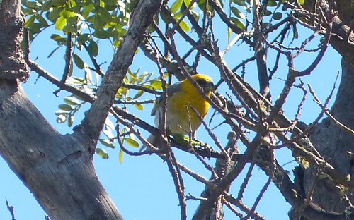
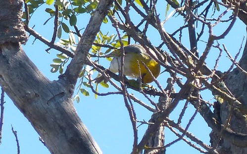
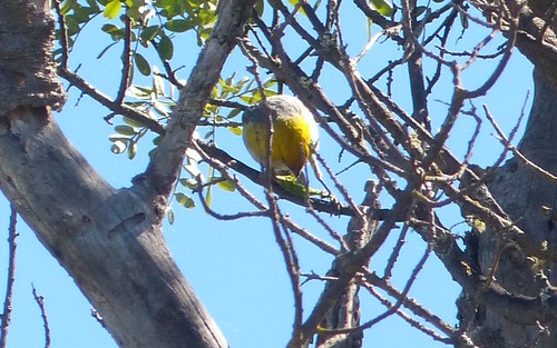
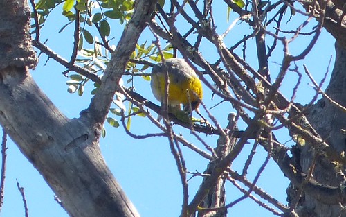
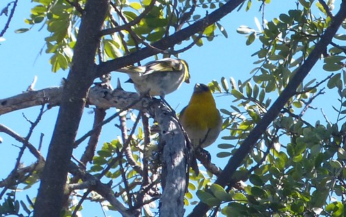
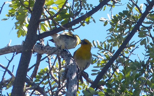
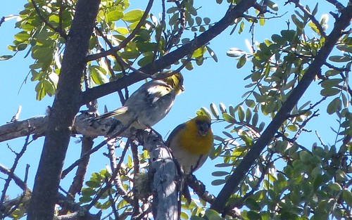
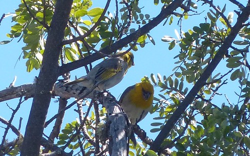
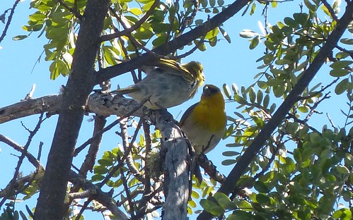
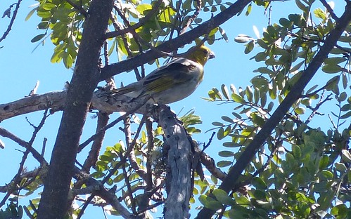
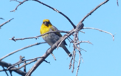
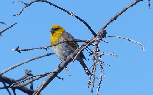
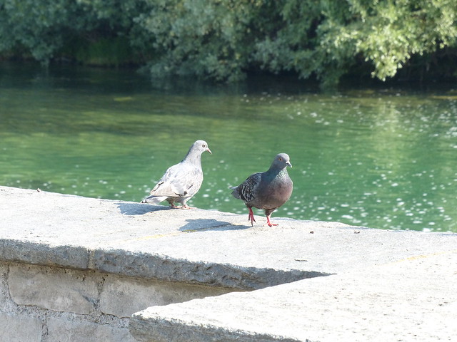
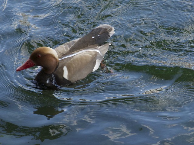
For the record, some of the species that we were able to identify from the train included: Red-winged Blackbird, Yellow-headed Blackbird, Rock Pigeon, Franklin’s Gull, Black Tern, American White Pelican, Northern Harrier, American Magpie, Ruddy Duck, Mallard, American Coot, Brown Headed Cowbird, America Crow, Lesser Scaup (the Greater Scaup breeds further north), Mourning Dove and Northern Pintail.

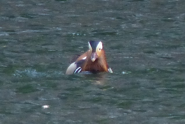
A number of unknown ducks, diving birds and shorebirds were also seen. Someone better at identification than me would have identified more species.

Saskatoon

Our first stop of the day had been in Saskatoon around 09:00 AM. The camera battery was out of juice so we did not take any pictures but we were able to wander around and stretch our legs while some Chipping Sparrows and a small flock of Franklin’s Gulls provided some entertainment.

Saskatoon is the largest city in Saskatchewan with a population of about 220,000 (260,000 in the metropolitan area).  It is a hub of many of the key industries in the province including potash mining, oil and agriculture.  Unfortunately, the train station was at the south end of the city and we did not see much of the city proper.

Melville

Stopped in Melville

Our second stop was in Melville at around 14:00. With a population of just under 5000, Melville is, as of the 2011 census, the smallest official city in Saskatchewan.

Melville is one of the standard CN stops and the train crew took advantage of it to change engineers. Our stop was relatively short but we were permitted to get off the train and walk around.

Arrival in Manitoba

After Melville, there were no more planned stops before Winnipeg though a couple of times we ended up sitting on a siding waiting for a freight train to pass. Shortly after Melville we arrived at the Qu’Appelle Valley.
Qu'Appelle ValleyManitoba WetlandsThe Qu’Appelle is a fairly large valley, gouged out by glacial melt-waters, that stretches from Lake Diefenbaker northwest of Regina all the way to the border with Manitoba. The small Qu-Appelle River runs through the valley. Shortly after we crossed into Manitoba, the Qu-Appelle ended, flowing into the larger Assiniboine.

We followed the Assiniboine for a while but in the end we parted ways to continue on a more direct route towards Portage la Prairie and Winnipeg while the river took a detour southward through Brandon.

Happy Birthday Rivers!

Rivers ManitobaAbout 80 km into Manitoba, we passed through a town call Rivers. I only found out later that Rivers was celebrating its 100-th anniversary in 2013 with the last day of celebrations being July 7, the day we passed through.

Happy Birthday Rivers!

Unfortunately, we weren’t allowed to stop and help them celebrate.

Crossing the Assiniboine

Crossing the AssiniboineOutdoor ArtOodena Celebration Circle
Canadian Museum of Human Rights
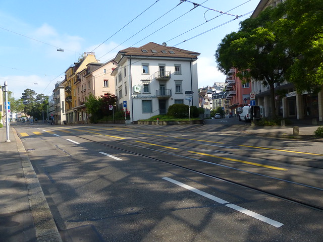
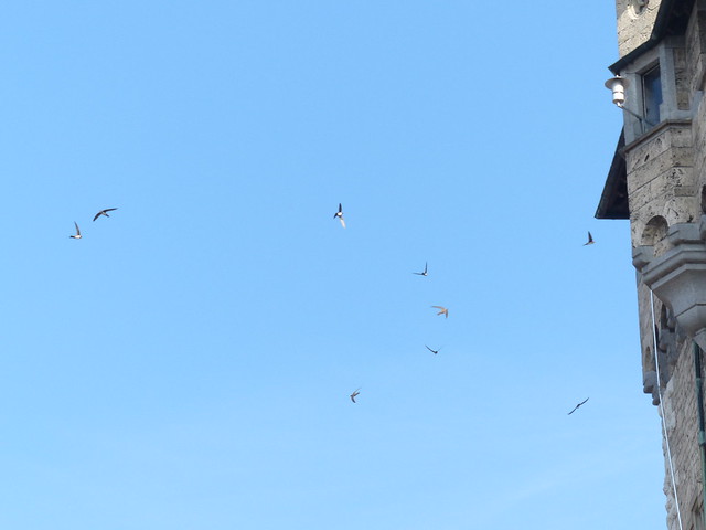
Around 20:30 we finally crossed the Assiniboine River and pulled into the main train station in Winnipeg. Our 90 minute stop provided enough time to explore the area called the Forks sitting on the north side of the Assiniboine where it meets the Red River.

Hard to miss was a music concert going on with a large crowd of onlookers watching and occasionally dancing to the music.  Exploring further, we found some interesting art and eventually came across the Oodena Celebration Circle, an amphitheater built to celebrate 6000 years of aboriginal peoples in the area.

Surrounding the central amphitheater were 8 Oodena Constellations designed around different constellations and stars and their associations with the seasons and the cultures of different native peoples.

On our way back to the train station, we passed by the Canadian Museum of Human Rights, a new national museum slated to open in 2014.

Winnipeg is the home to many, perhaps most of the train staff. When we left Winnipeg it was with a new crew that would see us all the way to Toronto.

It wasn’t long until the sun had completely set and we had arrived at the end of our third day.

More Links

All Day 3 Pictures on Flickr

Day 2: Kamloops to Jasper
Day 4: Northern Ontario

Vancouver to Toronto by Train Day 2: Kamloops to Jasper

Previous post: Day 1: Sunset Departure

Day 2 - Kamloops to Jasper Travel

Arrival in Kamloops

We awoke extremely early (for me at least), before dawn even at around 04:00.  With the curtains open we could watch the scenery go by without leaving the cabin.  Soon it was light enough to start taking pictures.
Kamloops LakeCrossing the North Thompson RiverNorth Kamloops Kingbirds Yellow-bellied Marmot
We had clearly left the coast behind as the terrain was noticeably more arid. We quickly figured out that we were moving along the northern bank of Kamloops Lake which is effectively a bulge in the Thompson River which eventually joins with the Fraser.

Kamloops in fact lies at the intersection of the Thompson River flowing out of Kamloops to the West and the South Thompson and North Thompson Rivers both of which flow into Kamloops from the East and North respectively.

We crossed the North Thompson River and made a left turn into the North Kamloops train station where we would get our first opportunity to get off the train and get a bit of exercise.  It was just before 06:00 when our feet hit the dirt.

There was the expected dawn wildlife activity. A number of noisy Western Kingbirds advertised their presence.  On the other hand, a Yellow-bellied Marmot almost went unnoticed as it watched us quietly from behind a hill of earth.

One lesson that we learned at Kamloops was to make sure you know when you have to board, not just when the train is due to leave.

When we finally pulled showed up to re-board,  all of the doors were closed and there were no conductors in sight.  A check in the train station found someone who eventually got us back on the train – but not before remarking that there was no need to worry as there would be another train in 3 days.

Following the North Thompson River

By 07:30, we were back on board for the next leg of the trip that would take us on toward Jasper Alberta..

Following the North ThompsonFollowing the North ThompsonFollowing the North ThompsonFollowing the North ThompsonThe CN tracks follow the North Thompson River for most of the way, eventually crossing the Continental Divide at the Alberta border.

Initially the river was wide and fairly slow flowing passing between hills covered in ‘snags’, a reminder of past forest fires. Grassy fields with browsing cattle and field full of round bales of hay were scattered along flat sections along the river.

The birding highlight of the day occurred about a half-hour out of Kamloops. On two separate occasions, a Lewis’s Woodpecker was seen flying close enough to the train to be identified with the red belly and grey/white collar easily seen. Our previous encounters with the Lewis’s Woodpecker occurred many years ago when we were living in Southern California.

If you check the breeding maps for the Lewis’s Woodpecker, you will see that this area of BC is pretty much at the northernmost part of their breeding range.

Other than the woodpecker sightings we saw relatively little animal activity.

A Stop in Blue River

Blue RiverBlue RiverBlue RiverAs we continued up the North Thompson River, the geography became more mountainous, and the river ran a little faster. Around 10:30, we rolled in to a small town called Blue River.

According to my (web) sources, Blue River is both halfway between Kamloops and Jasper and halfway between Vancouver and Edmonton. We arrived around 10:30 and were stopped on the tracks for a quarter of an hour or so (waiting for a freight train to pass as I recall).  It might have been a nice place to explore but we were kept on the train.

If you browse the Blue River Town Web-Page you will see that they refer to themselves as the Jewel of the Yellowhead – an outdoor destination for skiing and snowmobiling in the winter and cycling, hiking, camping and fishing in the summer.

The term Yellowhead appears in many geographical contexts in this part of BC. It appears to have originally referred to the blond hair of a metis trapper and is now attached to a number of geographical names including the Yellowhead Pass, which crosses the Great-Divide and separates British Columbia from Alberta, and The Yellowhead Highway (aka Highway 16) which runs from British Columbia, through the Yellowhead Pass, all the way to Manitoba.  It represents the northern branch of the Trans-Canada Highway which the CN train was following more or less.

Mountains, the River and a Waterfall

North of Blue RiverPyramid Creek FallsLooking BackThe scenery at this point was pretty impressive. The North Thompson was flowing faster and had the lighter colour indicating a higher silt content. We saw less evidence of man made structures as we began to climb towards the Yellowhead Pass and the forests now contained mostly conifers.

About 30 km North of Blue River, the CN tracks go right in front of the Pyramid Creek Falls in a Provincial Park of the same name. In fact the train passes so close that for a few seconds, looking out the right side of the train, all you can see is a wall of falling water.

The climb up the East edge of the valley soon became obvious providing some nice views of the valley looking back to the South.

Approaching the Great Divide

Mountain in the CloudsMountain ViewForests Showing Signs of Past FiresAs we approached the Yellowhead Pass, some of the larger mountains came into view. The mountain covered in clouds with a small section of snow-covered rock showing is, I believe, Mount Robson which is only clear of clouds a few days each year. Mount Robson is also the highest peak in the Canadian Rockies.

Some spectacular rock-faces were also seen along the way, some even seeming to glow in the early afternoon sunlight.

As at the lower altitudes, there were patches of mature forest with some large areas covered in gray snags indicating a fire in the not too distant past.

Birds and Bears

Bear in the WoodsWe only saw two raptors during the Kamloops to Jasper run. One was a Bald Eagle sitting in a tree and the other an Osprey flying overhead.

There were also a handful of ducks that we did not identify. A fair number of swallows, crows, pigeons and starlings were also seen.

On the other hand, there were two separate black bear sightings as we got closer to Jasper, one of which I captured with my camera as the train sped by (look for a black smudge at the base of a pine tree).

Jasper at Last

JasperJasperJasperJasperIn Jasper we were given about 90 minutes to explore the town. We got the postcard-sending out of the way first (though it took a while to find a mail-box).

Our original objective was to find a trail where we could go on a short ‘wilderness’ hike.  My own supplementary goal was to see some of the mountain bird species such as Boreal and Black-capped Chickadees, Stellar’s and Grey Jays, Clark’s Nutcrackers, Mountain Bluebirds, etc.  None of these was seen or even heard unfortunately (surprisingly) as the Rock Pigeons, European Starlings and House Sparrows appeared to have taken control of the town.

There was a noticeable tourist presence as we checked out the town though not so much as to be oppressive.

Finally, our time was up and we boarded the train for the final run out of the mountains.

Out of the Mountains

Leaving the RockiesGrassland and LakesSwallowedGrass and Trees
We were moving again by about 16:15.  Some of the rock formations seen as we moved out of the mountains were impressive. By 20:00 we were out of the mountains into the land of grassland and lakes.

It wasn’t much longer until we called Day 2 a wrap and went to bed.

More Links

All Day 2 Pictures on Flickr

Day 1: Sunset Departure
Day 3: Saskatchewan and Manitoba

Vancouver to Toronto by Train Day 1: Sunset Departure

Previous post:  Vancouver to Toronto by Train

The dogs were off at “doggy-camp”. While we were crossing the country by train and hanging out in Collingwood, they would be walking the dykes and forests of Maple Ridge.Vancouver DepartureSunset Behind the Port Mann Bridges  AH (our son) dropped us off at the Lougheed Mall SkyTrain station where we caught a SkyTrain to the VIA Rail station.

We had allowed for some delays and, as our travel to the station had gone without a hitch and we were sufficiently early that we had time to grab a bite to eat before entering the train station.

After ticket and identification checks we were allowed to board and check out our cabin, the observation cars and the various other areas that we would be our home for almost 4 complete days.

The train left on time and slowly crawled eastward through some of the urban  areas of Metro Vancouver.   We passed along the north edge of Burnaby Lake, crossed the Fraser River between New Westminster and Surrey and then followed the South Bank of the Fraser and underneath the new and old Port Mann Bridges.  After that, it was clear sailing.

We hit the sack early ending Day 1.

More Links

All Day 1 Pictures on Flickr

Day 2: Kamloops to Jasper