Author Archives: KevinHHood

Hiking in the Anza Borrego Desert State Park

The Anza Borrego Desert State Park is the largest state park in California stretching from the Mexican border north some 60 miles or so more north towards Palm Springs.  We went on a day trip and saw only one piece of the entire park hiking a single trail.  Nevertheless, we did get a sense of the park despite our short stay.

We left Palm Springs fairly early. The drive to the park is straight down the 10 interstate until you reach Indio at which point you branch onto the 86 and head south.  When you arrive at the town of Salton City, you take the S22 (also known as the Borrego Salton Sea Way) west.  The road is not in fantastic shape but it gets you to the park:
P1080212

Along the way you will see a large area of the land being used by off-road vehicles. There was a fairly visible presence of both off-road ATV type vehicles and camping vehicles from cars with small trailers to monster RVs.
P1080223

Eventually the road runs into Borrego Springs which is a small town based around a large oasis in the desert.
P1080225

This following was taken from the car as we drove into town:
P1080227

Like other desert environments in the US southwest, the Colorado Desert can be characterized by its vegetation.  The Sonoran Desert is known for its giant Saguaro cactuses; the Mohave Desert for its Joshua Trees.  The Colorado Desert, sometimes considered part of the Sonoran Desert, has creosote bushes, the ocotillo – not a cactus but a deciduous desert plant – and many other plant varieties.  The Western Fan Palm, the tree found at oases throughout the region and the only native palm tree in North America, is typically found in a Colorado Desert environment.

The visitor center for the park was be partially buried – presumably to help manage the extreme heat of the summer months:
P1080231

A short interpretive walk showcased some of the key aspects of the park and the Colorado Desert. Here is a large ocotillo which is not a true cactus:
P1080230

Between the various plants growing in the desert was some pretty cool looking, colourful ground cover.
P1080236

We came planning to take one good hike and the one that was recommended was the Palm Canyon Trail with trailhead a short drive away:
P1080239

The trail starts in a dry river bed. There was a surprising amount of vegetation and a fair number of plants were flowering.
P1080242

As we climbed out of the river bed the trail wound its way through a field of rocks and boulders.
P1080248
P1080254

There is lots of vegetation from many different plants to be seen along the way including this colourful ground cover.
P1080250

After a fair hike through the rocks we came around a ridge and got our first view of the oasis.
P1080256

The 2004 Flood

In September of 2004 a rainstorm dropped a large amount of rain on the area around the Palm Canyon. The resulting flash flood ripped apart the oasis leaving only a quarter of the trees standing. The remainder were scattered around, several being washed downstream by the fast flowing water. A good account of this event and the effects on the canyon is listed in the references at the bottom of this post.

Here are some of the palm trees that were ripped out of the ground during the flash flood.
P1080259

At times, the path to the oasis was somewhat creatively constructed around the large boulders.
P1080261

Some of the biggest boulders were found as we approached the oasis. The stream of running water became more obvious as well.
P1080262

How much power was their in the flood waters? Check this out:
P1080266

Finally – the Oasis:
P1080268
P1080274

The oasis comes with a small waterfall too.
P1080276

A pond with water just down from the waterfall is covered with what looks like duckweed. I wonder how that got here?
P1080277

We started back down the trail, eventually taking a different fork to follow a different trail back to the parking lot.

In case you didn’t get the scale of the earlier picture with boulder on trunk here is a version with boulder, trunk and me.
P1080282

The running water supports lots of different types of vegetation that look like they belong in a wetter climate.
P1080285
P1080289

Event away from the stream, there were many flowering desert plants.
P1080291
P1080292

As mentioned some of the logs were moved a long way down stream. This large palm trunk was found more than half way back to the parking lot.
P1080297

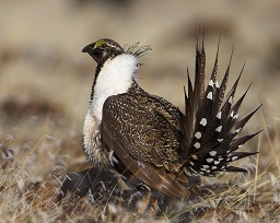
And that, as they say, is a wrap – to the hike at least. We didn’t see many birds and I wasn’t able to get much on camera. There was a Shrike and a high-up hawk and a few sparrows.

We stopped in Borrego Springs for lunch and then headed back on highway 78 which runs south of the S22 towards the south end of the Salton Sea. We were off to check out the Salton Sea National Wildlife Refuge though I’ll leave the details of that for another post.

References, and Further Reading

The article: Anza-Borrego: Plant Guide To Borrego Palm Canyon Nature Trail has extensive information on the Palm Canyon Trail, its vegetation and the September 2004 flood.

Hiking Indian Canyons

Whenever we are in the Palm Springs area we are always looking out for new places to hike and explore. Our regular favourite destinations include as the Coachella Valley Preserve in 29 Palms, the Palms to Pines Highway, Morongo Valley, Joshua Tree National Park and the Living Desert.

On our last Palm Springs visit we discovered a new hiking location, the Indian Canyons. On our most recent trip, we landed at the Palm Springs airport around noon and had a few hours before we could check in so we decided to revisit the Indian Canyons as they were not too far from the airport.

In fact, the Indian Canyons are easily reached from downtown Palm Springs by travelling south on Palm Canyon Drive South, also known as Highway 111B. When Highway 111B eventually turns east, becoming Palm Canyon Drive East, you need to turn off of 111B to continue south on Palm Canyon Drive South (now a more residential road).

Confusing?  Just stay to the right and keep going South.

Eventually you will reach the entrance to the Indian Canyons which lies on tribal lands of the Agua Caliente Band of Cahuilla Indians. An entrance fee is required to continue. It is not much further that the road comes to an end as a bunch of parking lots and a visitor centre called The Trading Post which has toilets, souvenirs, knowledgeable staff ready to answer questions and useful hiking stuff like sun-hats for those who (like me) left theirs at home.

For those who enjoy watching hummingbirds, there are several hummingbird feeders that always seem to have lots of activity. See my previous post: Hummingbirds at the Indian Canyons Trading Post.

For those coming to hike, some good trail maps can be found online at this Indian Canyons web site.

Fire and Flood

Flash flood warning P1080053

2013 saw some extremely heavy September rains in and around the Coachella Valley. The Indian Canyons was one of the areas that suffered damage from flash floods resulting from these storms. In this case the problem was worsened by a July fire that damaged some 6000 acres of the Agua Caliente tribal lands. After the flooding, access to the Indian Canyons was closed indefinitely. Lucky for us, access was restored in mid-November.

Palm Canyon Trail

The Trading Post sits protected from flash floods on a small ridge overlooking part of the oasis running along the Palm Canyon Creek. A switchback path providing access to the trail. After watching the hummingbirds for a while and buying a sun-hat we hiked down to the canyon floor and into the world’s largest native oasis of Desert Fan Palms (Washingtonia filifera), also know as California Palms. We continued up the trail into the 15 mile long canyon. Here are a few pictures taken along the way.
Palm Canyon Trail P1080054

Part of Palm Canyon Trail P1080062

Palm trees and water in Palm Canyon Creek P1080063

In places we could see evidence of the July fire. You can see burn marks on some of the palms going all the way up to the base of the palm fronds.
California Fan Palms - some burnt by July 2013 fire P1080066

Finally, at around the 2 mile mark we reached the start of the Victor Trail that would take us back to the Trading Post through the open desert.
Crossroads and start of VIctor Trail P1080064

Victor Trail

View looking back towards the creek a short way up the Victor Trail.At start of Victor Trail looking back at California Fan Palms P1080067

Looking up the Victor Trail. The rocky landscape is scattered with creosote bushes, barrel cactuses and other vegetation.Victor Trail view of desert P1080071

A Teddy Bear Cholla cactus on the edge overlooking Palm Canyon.  Cute? Perhaps.  Cuddly?  Nope.  Some of the spines are pretty fine and definitely not for touching.Teddy Bear Cholla Cactus P1080074

A barrel cactus along the Victor Trail. The spines from some small ‘baby’ cactuses at the base of the larger cactus are catching the sunlight and appear to glow.Barrel Cactus P1080076

At several points along the trail you can see all the way back to the Trading Post. Here is one such view showing the extent of the oasis along the creek. The San Jacinto mountains are rising on the left.
Victor Trail view of Palm Canyon P1080077

At one of the high points we got a good view looking northward towards Palm Springs. You can clearly see some of the wind farms north of the city. In the distance is, I believe, the southern end of the San Bernardino Mountains.
Victor Trail view SE showing Palm Springs and windmill farm P1080078

Another view of the Trading Post as we get closer to the end of the trail.
Victor Trail view looking towards Trading Post P1080083

Here is a view of the rocks and vegetation along the trail. Some of the rocks suggest a lot of geological upheaval over time which is expected given the proximity of the San Andreas Fault.
Victor Trail P1080085

We saw several types of cactus along the trail. I’m not sure what kind is in the foreground.
Unknown cactus backlit by late afternoon sun P1080087

The Palm-Canyon/Victor trail was a short loop of only about 4 miles yet, because of the elevation gains on the Victor Trail portions is rated as moderately strenuous. We hiked it in January and took no special precautions other than carrying water (and I had my new sun-hat). Because of the time of year we were also not too concerned with potential animal threats such as rattlesnakes, scorpions or tarantulas. Anyone hiking these trails during warmer times of the year should take the appropriate precautions.

Hummingbirds at the Indian Canyons Trading Post

The city of Palm Springs lies nestled up against the northeast corner of the San Jacinto Mountains, the northernmost of the Peninsular Ranges, a group of mountain ranges that extend along the coast as far as the southern tip of the Baja California peninsula in Mexico.

Driving due South from Palm Springs along Palm Canyon Drive takes you into a pocket in the mountains that includes part of the tribal land for the Agua Caliente Band of Cahuilla Indians. This area is referred to as the Indian Canyons that is accessible for a number of activities. Numerous trails of varying length and difficulty are available for hiking and for equestrian use. Some good trail maps can be found at this Indian Canyons web site.

At the end of Palm Canyon Drive are several parking lots and The Trading Post that is the starting point for several of the trails. If you want trail advice or just a souvenir, you find it at the Trading Post.  And if, like me, you forget to bring a sun hat, they’ve got that covered as well.

The Hummingbirds

For those who like to watch hummingbirds, they have several feeders which have been quite active the two times that we have been there. During this visit, most of the hummers that we saw were Costa’s though the odd Anna’s was seen as well. This was actually not a problem since, being from the Vancouver area, we see Anna’s Hummingbirds all the time so I was more interested in the Costa’s hummingbirds anyways.  Because of the feeder locations, you can sit at one of the covered picnic tables to watch the hummers come and go.

The following two images show a male Costa’s with its lovely deep purple colouration on throat and head.  Depending on the direction of the light, I have seen the colour go from black to a deep blue.Costa's Hummingbird-1080137

Costa's Hummingbird-1080147

The hummers appear to be fairly used to the humans so you can approach to within a few feet of the feeders and get a good view without having them fly away. If you have a camera with a reasonable zoom capable of fast shutter speeds, you can get some pretty good pictures too.

One Feeder – Three Costa’s

The following sequence of pictures show 3 Costa’s hummingbirds, 1 male and 2 female, as they go after the nectar in one of the feeders. The sequence starts with 1 male and 1 female both perched with the second female arriving to join in. Both of the feeding hummers initially stopped feeding, I suppose to check out the new arrival.
Costa's Hummingbirds-1080115

Costa's Hummingbirds-1080116

In the next 3 images you can see the seated hummer apparently ‘chirping’ at the new arrival when it gets too close. This appears to be successful at keeping the new bird away. The male seems content to let the females sort things out.Costa's Hummingbirds-1080118

Costa's Hummingbirds-1080119

Costa's Hummingbirds-1080120

The entire sequence lasted only a few seconds.  The first 5 images (above) were taken over about 1 second using my camera’s burst mode which was set to take 5 pictures per second for a burst of up to 11 images.

Eventually the late arrival moves off and re-appears at an empty spot on the far side of the feeder.  In fact, as this image was taken 6 seconds after the first 5, this could be a fourth hummer coming for a sip.Costa's Hummingbirds-1080122

Costa’s meets Anna’s

The next picture shows both a male Costa’s and a female Anna’s facing each other on opposite sides of the same feeder. You can clearly see the larger size of the Anna’s Hummingbird.  Another difference between the species is visible.  In the Anna’s, when perched, the tail extends noticeably past the wingtips whereas in the Costa’s the wingtips and tail end at roughly the same point.
Male Costa's and Female Anna's Hummingbirds-1080151

An interesting observation that is clear in this image is that when the two hummers are perched face-to-face, it appears that the center of balance of both is outside of the perching ring.  In effect they are leaning backwards using their grip to prevent them from falling off of the perch.  Why wouldn’t they just sit with their centre of balance over the perch?  One reason that I can think of is that this allows for a quick escape by, in effect, ‘falling’ off of the perch.

The staring contest ended with the Anna’s departure.  Note that the Anna’s departure is low, below the feeder consistent with a “quick getaway by falling off the perch“.
Male Costa's and Female Anna's (disappearing) Hummingbirds-1080152

Final Thoughts

The dynamics of hummingbirds competing for spots on a feeder is always entertaining.  These birds move so quickly, however, that capturing the details would be all but impossible without a camera having a high-shutter speed, burst mode and a good optical zoom.  A tripod would be useful though the above pictures were all taken with the camera hand-held.  The built-in image stabilization no double helped create sharp images without a tripod.

The progress of camera technology is impressive.  A few years ago, taking the above images would probably have required thousands of dollars worth of camera equipment.  I took them all using a Panasonic DMC-FZ200 which currently goes for well under $1000.


Leucistic Dark-eyed Junco (and Friends)

We spent the past weekend on Saltspring Island. The front yard feeders where we were staying attracted a good crowd of birds about 90% of which were Dark-eyed Juncos. One particular bird was there most of the time and sported some discolouration on its head which I attribute to Leucism. The first two pictures are views from left and right showing that the discolouration is not symmetric.

Leucistic Junco-1070974

Leucistic Junco-1070980

The following view with the junco looking almost directly at the camera also clearly shows the left-right asymmetry.
Leucistic Junco-1070964

There was also a small group of American Goldfinches that showed up occasionally. Some of them posed nicely for the camera too:
American Goldfinch-1070960

American Goldfinch-1070962

The back yard had some bird activity as well including a Chestnut-backed Chickadee, a Fox Sparrow and an American Robin.
Chestnut-sided Chickadee-1070917

Fox Sparrow-1070926

Robin in Birdbath-1070941-2

Greater Sage-Grouse Granted Emergency Protection Order in Canada

GreaterSageGrouse 256x204
By Pacific Southwest Region U.S. Fish and Wildlife Service from Sacramento, US (Greater Sage GrouseUploaded by Snowmanradio) [CC-BY-2.0], via Wikimedia Commons

This story was brought to my attention through a post on the BCVIBIRDS forum.

Earlier this month the Greater Sage-Grouse, now almost extirpated from Canada, was granted a first ever emergency protection order by the federal government.  One direct effect of this order is that a number of existing and planned oil and gas projects will be either curtailed or preventing on some 1700 square kilometers of provincial and federal crown land in both Alberta and Saskatchewan.

While an important precedent for species protection, it is not clear that this order will be in time to save the Canadian populations of Sage-Grouse.  The numbers in Canada are currently estimated at around 100 birds, down by as many as 25 from the year before.

In the US there is still a significant population but, at least in some areas, local populations are decreasing rapidly mostly due to habitat loss.  The US government is considering listing the Greater Sage Grouse as endangered in both Nevada and California.

References and Further Reading

Nature Canada, Endangered Species, Species Spotlight: Greater Sage-Grouse.

Nature Canada, Newsroom, 2013-12-04: Nature conservation organizations across Canada applaud emergency order protecting endangered species, caution more action is neededNature conservation organizations across Canada applaud emergency order protecting endangered species, caution more action is needed.

gazette.gc.ca, 2013-12-04:  Federal Government Gazette with original order.

Associated Press, foxnews.com, 2013-10-25:  Feds propose listing sage grouse sub-population as threatened, angering energy developers.

Schroeder, M. A., J. R. Young and C. E. Braun. 1999. Greater Sage-Grouse (Centrocercus urophasianus), The Birds of North America Online (A. Poole, Ed.). Ithaca: Cornell Lab of Ornithology; Retrieved from the Birds of North America Online: http://bna.birds.cornell.edu/bna/species/425; doi:10.2173/bna.425

Bob Weber, globalnews.ca, 2013-12-04: Sage grouse protection plan released.

River Otter Snacking (Video)

I finally got around to putting together the following river otter video from a short video clip that I captured last spring:

What reminded me of the video clip was a wonderful sequence of river otter pictures recently posted by a fellow member of the Fraser Valley Birding forum who is also a great photographer.

I also created the following YouTube version of the River Otter video.

The footage for the video was taken in Town Centre Park in Coquitlam, BC.  We’re not sure how the otter got into “Lafarge Lake” (the name for the glorified pond on the site of an old quarry) however we do have a pretty good idea why he liked it there. Except during the hottest months of the year, the pond is stocked with fish for anyone to come and try to catch. For the otter, it’s a free buffet in addition to all of the yummy things that occur naturally in the pond such as the crunchy morsel with claws that it is eating in the video.

Lake Lafarge River Otter-1000837

River Otter in Lafarge Lake, Town-Centre Park, Coquitlam, April 2013. Copyright 2013, Kevin H Hood, all rights reserved.

The camera was hand-held during the recording and Adobe Premiere Elements Video Editor (version 11) was used to touch up the original footage and to publish it to YouTube.  The original sound-track was filtered to reduce background noise but was otherwise left untouched and consists of background (city) noise, a crow calling and, if you listen carefully, something that might be the sound of the otter crunching on its snack.

Lake Lafarge River Otter-1000838

River Otter in Lafarge Lake, Town-Centre Park, Coquitlam, April 2013. Copyright 2013, Kevin H Hood, all rights reserved.

Puzzler #5: Camouflage 101

When I first looked at the picture, I thought that I had totally botched the shot. The bird that I had seen seconds earlier appeared to have disappeared. A careful inspection of the entire image confirmed that I had captured enough of the bird to make an ID.

Now its your turn to find and identify the bird.

Clues

(See Puzzlers Page for Instructions)

Clue #1: Gur oveq vf uvqqra va cynva fvtug.

Clue #2: Guvf cvpgher jnf gnxra ng gur Gfnjjnffra Sreel Qbpx va Oevgvfu Pbyhzovn, Pnanqn ba Whyl 20 bs guvf lrne.

Answer

Vg vf n Ehqql Gheafgbar naq vg vf “uvqvat” whfg nobir gur jngre yvar n yvggyr gb gur yrsg bs prager.

Bird Puzzler #4: Family Affair

The fledgling bird in the following picture along with a sibling (not shown) and an adult (also not shown) were seen flitting around in some cottonwoods somewhere in Canada during the summer of 2013.

Your goal is to guess the species.

Clues

(See Puzzlers Page for Instructions on decoding clues)

Clue #1: Here is a recording of the begging calls (the continuous clicking sounds) made by the 2 young birds as they chased an adult bird through the cottonwoods.

Clue #2: Gur cvpgher jnf gnxra jvguva jnyxvat qvfgnapr bs bhe ubhfr va Pbdhvgynz, OP ba Pnanqn Qnl, 2013.

Clue #3: Lrf, vg vf n jneoyre.

ANSWER

The answer including a picture of all three birds can be found on the next page …

Link

This is a follow-up to a previous post summarizing the September 2013 issue of Avian Conservation & Ecology that features several articles with the theme of human-related bird mortality in Canada.

A thread on one of the birding groups that I follow was discussing the effect of wind power on birds and one of the contributors pointed to the Barnard on Wind web site (creator: Mike Barnard).  More specifically they referenced the article: How significant is bird and bat mortality due to wind turbines?  This article, along with its extensive list of references, contains a wealth of information for anyone interested in understanding the effects of wind-power on bird populations.  One of the references in Mike’s article is, in fact, the same article on the effects of wind-power that is referenced by the September issue of Avian Conservation &Ecology.

It’s a great and informative site that’s definitely worth a bookmark.

Bird Puzzler #3: Hide and Seek

I was surprised when I learned this fact about this bird-species that breeds in BC and that is seen fairly regularly in the lower mainland.  This puzzler has no pictures, videos or sound recordings – just the following piece of information:

This is the only North American migratory species that, at the turn of the twenty-first century, had not yet revealed the location of its wintering grounds.

These wintering grounds were only finally discovered in 2010 and how it was done is very cool!

Identify that bird!

Clues

(See Puzzlers Page for Instructions)

Clue #1: Gurl bsgra unat bhg arne jngresnyyf.

Clue #2: Qb abg zvfgnxr gurz sbe ynetr, qnex-pbybherq fjnyybjf.

PuzzlerDecryptor

Clue and Answer Decoder

Answer

Gur zlfgrel oveq vf gur Oynpx Fjvsg.  N tebhc bs Pbybenqb erfrnepuref gnttrq 4 oveqf jvgu trbybpngbef va 2009 naq, jura 3 bs gurz jrer erpncgherq va gur fhzzre bs 2010, gur frperg bs gurve jvagrevat tebhaqf va gur Nznmba Onfva va gur jrfg bs Oenmvy jnf erirnyrq.

Zl bevtvany fbhepr jnf gur Rneoveqvat.pbz oybt  negvpyr ol Anguna Cvrcybj: Oynpx Fjvsg Jvagrevat Tebhaqf Qvfpbirerq (uggc://rneoveqvat.pbz/oybt/nepuvirf/3602).